| Area |
The country has an area of 148,460 square kilometres (57,320 sq mi) and extends 820 kilometres (510 mi)
north to south and 600 kilometres (370 mi) east to west. Bangladesh is bordered on the west, north, and east
by a 4,095 kilometres (2,545 mi) land frontier with India and, in the southeast,
by a short land and water frontier (193 kilometres (120 mi)) with Burma (Myanmar).
|
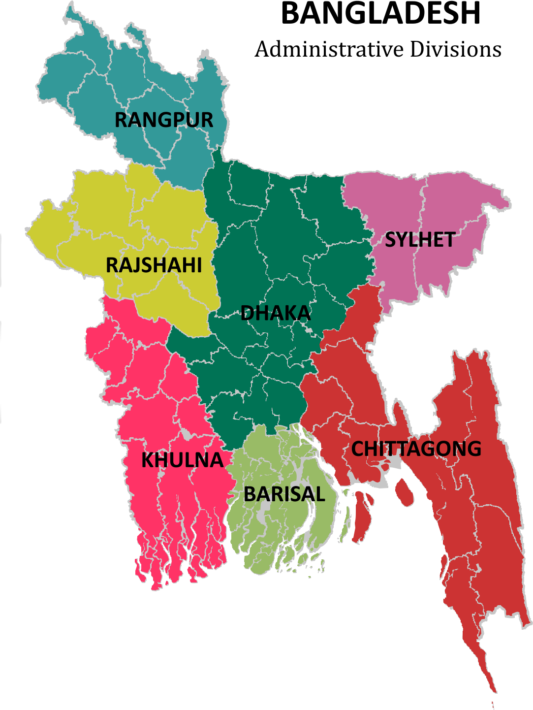
| Capital |
Dhaka |
| People |
98% Bengalis 2% minorities |
| Population |
161,376,708 approx. |
| Topography |
Bangladesh is a tropical country, situated mainly on the deltas of large rivers flowing from the Himalayas.
The Brahmaputra River, known locally as the Jamuna, unites with part of the Ganges to form the Padma, which,
after its juncture with a third large river, the Meghna, flows into the Bay of Bengal. Offshoots of the Ganges-Padma,
including the Burishwar, Garai, Kobadak, and Madhumati, also flow south to the Bay of Bengal.
|
| Weather |
Bangladesh is exceptionally vulnerable to climate change.
Its low elevation, high population density and inadequate infrastructure
all put the nation in harm’s way, along with an economy that is heavily reliant on farming.
|
| Seasons |
There are three distinct seasons in Bangladesh: a hot, humid summer from March to June; a cool,
rainy monsoon season from June to October; and a cool, dry winter from October to March.
In general, maximum summer temperatures range between 30°C and 40°C.
|
| Time zone |
UTC+6 (BST) |
 Bangladesh is one of the few countries in South Asia, which remains to be explored.
Bangladesh has a delicate and distinctive attraction of its own to offer. Bangladesh has
a land of enormous beauty, hundreds of serpentine rivers, crystal clear water lakes surrounded by ever green hills,
luxuriant tropical rain forests, beautiful cascades of green tea gardens, world's largest mangrove forest preserved as World Heritage,
home of the Royal Bengal Tiger and the wild lives, warbling of birds in green trees,
wind in the paddy fields, abundance of sunshine, world's longest natural sea beach.
Bangladesh is one of the few countries in South Asia, which remains to be explored.
Bangladesh has a delicate and distinctive attraction of its own to offer. Bangladesh has
a land of enormous beauty, hundreds of serpentine rivers, crystal clear water lakes surrounded by ever green hills,
luxuriant tropical rain forests, beautiful cascades of green tea gardens, world's largest mangrove forest preserved as World Heritage,
home of the Royal Bengal Tiger and the wild lives, warbling of birds in green trees,
wind in the paddy fields, abundance of sunshine, world's longest natural sea beach.